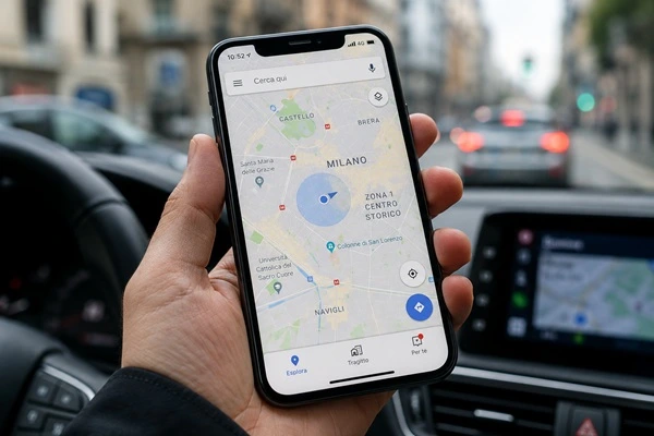
Every day, millions of people use their smartphones to get directions, find nearby businesses, share their location, or simply check where they are on a map.
Most people assume that all of this is possible thanks to GPS alone. In reality, modern smartphones use several different technologies working together to determine a device’s location as accurately as possible.
GPS satellites, cellular towers, Wi-Fi networks, and assisted positioning systems all play an important role in modern smartphone tracking and geolocation.
Understanding how these technologies work helps explain not only how navigation apps operate, but also how many location-based services, security applications, and remote monitoring systems function today.
GPS Is the Main Technology, But It Doesn’t Work Alone
When people think about smartphone location tracking, GPS is usually the first thing that comes to mind.
GPS, or Global Positioning System, is indeed the primary technology used to determine a smartphone’s location.
However, GPS is only one piece of a much larger system.
If you’ve ever noticed your phone finding your location almost instantly inside an airport, shopping mall, or office building, you’ve already seen other positioning technologies at work.
Modern smartphones combine multiple location sources simultaneously to provide faster and more accurate positioning.
This approach allows the device to continue working even when GPS signals become weak or unavailable.
How GPS Works on a Smartphone
GPS stands for Global Positioning System, a satellite-based navigation network originally developed for military use and later made available for civilian applications.
Today, dozens of satellites orbit the Earth and continuously transmit information about their location and timing.
Your smartphone receives these signals and uses them to calculate its position.
Contrary to what many people believe, your phone does not send signals to GPS satellites.
Instead, it simply listens to the satellites and processes the information it receives.
To calculate an accurate position, the device needs signals from multiple satellites at the same time.
The more satellites the phone can detect, the more accurate the location becomes.
Under ideal conditions, a modern smartphone can determine its location within just a few feet of its actual position.
This level of precision is what makes modern navigation applications so effective.
Why GPS Isn’t Always Enough
If GPS worked perfectly everywhere, smartphones wouldn’t need any additional positioning technologies.
Unfortunately, real-world conditions are rarely perfect.
GPS signals must travel from satellites in space to your smartphone on the ground. Along the way, they can be weakened or blocked by various obstacles.
Common examples include:
- Underground parking garages
- Tunnels
- Airports
- Shopping malls
- Large office buildings
- Dense urban areas with tall skyscrapers
In these situations, the phone may struggle to receive strong satellite signals.
This is why smartphone manufacturers developed additional technologies that help maintain accurate location tracking even when GPS performance is reduced.
Cell Tower Triangulation
One of the most important backup systems used by smartphones is cellular tower positioning.
Whenever your phone is turned on, it constantly communicates with nearby cell towers operated by your mobile carrier.
These towers provide more than just phone calls and internet access.
They can also help estimate your location.
By analyzing which towers are connected to the device and measuring signal strength from multiple towers, the network can calculate an approximate position.
This method is often called cell tower triangulation.
While it is generally less accurate than GPS, it offers one major advantage: it works even when satellite signals are unavailable.
In urban areas with many cellular towers, location estimates can be surprisingly accurate.
As a result, cellular positioning plays a crucial role in smartphone geolocation systems.
How Wi-Fi Positioning Works
Many people associate Wi-Fi exclusively with internet access.
In reality, Wi-Fi networks also play a significant role in location services.
Over the years, companies have built massive databases containing the geographic locations of millions of Wi-Fi routers around the world.
When your smartphone detects nearby Wi-Fi networks, it can compare them with these databases to estimate its current location.
This process is known as Wi-Fi Positioning.
It is particularly useful indoors, where GPS signals are often weaker.
For example, if you’re inside a large shopping center or office building, your phone may use nearby Wi-Fi networks to determine your location much faster than GPS alone.
This is one reason why modern smartphones can often provide accurate positioning even when you’re far away from an open sky.
What Is A-GPS?
Another technology that improves smartphone geolocation is A-GPS, which stands for Assisted GPS.
Many users notice that their phones can determine their location within seconds.
A-GPS is one of the main reasons for this speed.
Normally, a GPS receiver must download information directly from satellites before calculating a position.
This process can take time, especially if the device hasn’t used GPS recently.
A-GPS speeds things up by using an internet connection to download satellite data in advance.
Instead of waiting for the information to arrive from space, the smartphone receives assistance through cellular data or Wi-Fi.
As a result, the device can locate satellites much faster and provide near-instant positioning.
Today, A-GPS is a standard feature in virtually all modern smartphones.
Smartphone GPS Tracking and Location Services
GPS technology is about much more than navigation.
Today, location services are used in countless applications and industries.
Some common examples include:
- Turn-by-turn navigation
- Fitness and outdoor activities
- Ride-sharing services
- Lost device recovery
- Fleet management
- Logistics and transportation
- Personal safety applications
- Location-based services
Many apps continuously collect location data and create a history of movements over time.
This information can be used to improve services, provide directions, or help users locate devices when needed.
Location tracking has become one of the most important features available on modern smartphones.
How All These Technologies Work Together
The most impressive aspect of modern smartphone geolocation is that no single technology works alone.
GPS, cell tower positioning, Wi-Fi databases, and A-GPS all operate together.
The smartphone constantly evaluates available signals and chooses the most reliable information at any given moment.
If GPS reception is excellent, the device relies primarily on satellite data.
If satellite signals become weak, Wi-Fi positioning and cellular towers can help maintain accuracy.
This combination allows smartphones to provide reliable location information in almost any environment.
How GPS Location Works on a Monitoring Smartphone
So far we’ve explained how a smartphone determines its location using GPS satellites, cell towers, Wi-Fi networks, and Assisted GPS.
But how does this work on a monitoring smartphone?
From a hardware perspective, there is usually very little difference. Most monitoring smartphones use the same GPS receiver found in any modern mobile device.
The real difference lies in the software.
A regular smartphone uses GPS mainly for navigation, maps, weather apps, or finding nearby places. A monitoring smartphone, however, is designed to make location information available remotely, allowing an authorized user to check where the device is from another location.
Instead of simply showing your position on the phone’s screen, the system can continuously collect location data and make it available through a secure remote platform.
In other words, GPS is no longer used only for navigation. It becomes a tool for tracking the device’s movements over time.
How Location Data Is Sent
Every time the smartphone calculates its position, the GPS coordinates can be transmitted through the device’s internet connection, whether it’s using 4G, 5G, or Wi-Fi.
An authorized user can then log into a secure dashboard and view the phone’s location directly on a map.
Location updates can usually be customized depending on the intended use.
For example, the device can report its position:
- every few seconds;
- once every minute;
- every few minutes;
- only when movement is detected;
- or only when specific conditions are met.
Choosing the right update interval is a balance between tracking accuracy and battery life.
Frequent updates provide nearly real-time tracking, while longer intervals help reduce power consumption and extend battery life.
Location History
One of the most useful features of a monitoring smartphone is the ability to review location history.
Every GPS update is stored together with its date and time, creating a detailed record of where the device has been.
This allows authorized users to view previous routes on a map, check arrival and departure times, or review movements over a specific period.
Instead of seeing only the current location, it’s possible to understand how the device has moved throughout the day.
The level of detail depends on how often GPS positions are recorded.
More frequent updates produce a more accurate travel history, while longer intervals generate a broader overview of the device’s movements.
Geofencing and Automatic Alerts
Many monitoring smartphones also include a feature known as geofencing.
The idea is simple.
A user creates one or more virtual boundaries on a map and defines what should happen when the device enters or leaves those areas.
For example, a geofence can be placed around a home, office, warehouse, construction site, or any other location of interest.
Whenever the smartphone crosses one of these virtual boundaries, the system can automatically send a notification.
This eliminates the need to constantly check the device’s location manually.
Geofencing is widely used in professional environments because it provides immediate alerts whenever important location changes occur.
Notifications can usually be customized to match different monitoring needs.
GPS Accuracy, Battery Life, and Update Frequency
A common question is how accurate a monitoring smartphone really is.
The answer is simple.
Because it relies on the same GPS technology found in standard smartphones, positioning accuracy is generally the same.
Actual precision depends on several factors, including satellite visibility, nearby buildings, Wi-Fi coverage, and cellular signal quality.
Battery life is another important consideration.
Keeping GPS active all the time would quickly drain the battery.
For this reason, advanced monitoring systems use intelligent power management to optimize GPS operation.
For example, the device may increase the frequency of location updates while it’s moving and automatically reduce them when it remains stationary.
Some systems can even activate GPS only when needed, helping preserve battery life without sacrificing reliable location tracking.
This balance between accuracy, update frequency, and power consumption is one of the key features that distinguishes professional monitoring smartphones from standard location-sharing apps.
Conclusion
Many people assume that smartphone location tracking depends entirely on GPS. In reality, modern geolocation is much more sophisticated.
GPS satellites, cellular tower triangulation, Wi-Fi positioning, and Assisted GPS all work together to determine a device’s location quickly and accurately.
This combination of technologies is what makes today’s smartphones capable of delivering reliable navigation, real-time location services, and advanced tracking capabilities.
From everyday map applications to professional monitoring systems, geolocation has become one of the most important technologies built into modern mobile devices.