
Endoacustica offers, Exclusive Customer Service and free Training


ZeroTrace · GPS & BeiDou jammer
ZeroTrace GPS & BeiDou Jammer for Vehicles
A compact GPS and BeiDou jammer for vehicle applications, with USB power, an OBD connection option, and a built-in rechargeable battery.
- Targets GPS L1 and L2, with listed BeiDou support.
- Stated operating range of 5–10 meters, depending on conditions.
- 5 V USB power and a vehicle OBD power option.
- Up to 2 hours of battery life under ideal conditions. Actual runtime varies with use.
Product code: ZeroTrace
Contact Us for Pricing
Tell us about your vehicle and power requirements. Our team can help assess suitability and provide pricing.
Free consultation, training and support.
Speak to our team: +39 080 302 6530
Product overview
Compact Design. Flexible Power.
GPS and BeiDou
Targets GPS L1 and L2 satellite-navigation reception, with BeiDou support listed in the product specifications.
USB, OBD, or Battery
Choose 5 V USB power, a compatible vehicle OBD power connection, or the built-in rechargeable battery.
240 g
The lightweight unit is designed for vehicle applications and temporary use. Stated operating range is 5–10 meters, depending on conditions.
Product details
Full description
Vehicle-Focused Satellite-Signal Interference
ZeroTrace is a compact jammer designed to interfere with GPS L1 and L2 reception, with support for BeiDou also listed. It works on satellite-navigation reception within a stated range of 5–10 meters; actual coverage depends on the receiver and surrounding conditions.
The listed frequency ranges are 1500–1600 MHz for L1 and 1200–1300 MHz for L2. BeiDou is a satellite-navigation system used for positioning, navigation, and timing. Receivers may use more than one navigation system, so interference with the listed signals does not establish that every form of location tracking will stop.
Three Power Options for Vehicle Applications
The 240 g unit can run from a 5 V USB supply, its built-in rechargeable battery, or a compatible vehicle OBD power connection. External power supports extended operation while a suitable supply remains available.
Battery life is up to 2 hours under ideal conditions. Actual runtime varies with use. The OBD connection serves as a power option; confirm the appropriate connection for your vehicle and supplied configuration.
Technical specifications
| Product code | ZeroTrace |
|---|---|
| GPS L1 frequency range | 1500–1600 MHz |
| GPS L2 frequency range | 1200–1300 MHz |
| Additional navigation system | BeiDou; exact supported bands should be confirmed for the configuration |
| Stated operating range | 5–10 m; actual effectiveness varies with conditions |
| Weight | 0.24 kg (240 g) |
|---|---|
| External power | 5 V USB / vehicle OBD power option |
| Battery | Built-in rechargeable battery |
| Battery runtime | Up to 2 hours under ideal conditions. Actual runtime varies with use. |
| External-power operation | Extended operation while a suitable continuous power supply is available |
Applications
Vehicle-focused applications for authorized operators assessing satellite-navigation privacy and interference requirements.
Company Vehicles
For organizations assessing location-privacy requirements across company cars and service vehicles. The compact format suits vehicle-based applications, while USB and OBD power options provide alternatives to battery operation. Compatibility with the vehicle’s navigation and fleet systems should be reviewed as part of the assessment.
Rental Vehicles
For authorized rental operators evaluating GPS and BeiDou reception in their own vehicles. The lightweight unit and built-in battery support temporary assessments without depending on permanent power availability. Any use should remain within the operator’s permissions and the vehicle’s applicable requirements.
Transport Fleets
For authorized operators reviewing satellite-navigation requirements in trucks, buses, and other transport vehicles. External power provides an option for extended assessments, while the stated 5–10 m range remains dependent on the installation environment. Fleet navigation, dispatch, and safety systems should be considered together when assessing suitability.
Technology overview
What is BeiDou? China’s global satellite navigation system
How BeiDou works
BeiDou is China’s global navigation satellite system, or GNSS. Like the U.S. GPS system and Europe’s Galileo, it provides positioning, navigation and timing services. China developed the network to establish its own independent satellite navigation infrastructure.
The name BeiDou (北斗) refers to the Big Dipper, the seven-star pattern within the constellation Ursa Major. The system expanded from regional service to worldwide coverage with BeiDou-3, completed and commissioned in 2020.
Satellites broadcast their position and precise timing information. A receiver uses the signals’ travel times to estimate its distance from each satellite, then calculates its location. A standard three-dimensional position fix normally requires at least four satellites to resolve position and the receiver’s clock error.
This process uses distance measurements rather than angles. It is the same basic positioning principle used by other global satellite navigation systems.
Sources: BeiDou-3 global service; NOAA: satellite positioning explained.
Coverage, compatibility and everyday uses
Compatible multi-GNSS receivers can use BeiDou alongside GPS, Galileo and GLONASS. Access to more satellites can help maintain a position fix when buildings or other obstacles block part of the sky. Support depends on the receiver and the signals it can process.
BeiDou also provides regional services in the Asia-Pacific area. That does not make it universally more accurate than GPS: real-world performance depends on satellite geometry, reception conditions, signal selection and receiver quality.
Common uses include vehicle navigation and tracking, smartphone maps, fleet management and transportation. Positioning and timing services support applications across road, maritime and aviation operations.
BeiDou serves civilian users as well as government and defense applications, with different services and access arrangements. For a specific device, check its supported constellations and signals rather than assuming that every GNSS receiver supports BeiDou.
Sources: Official BeiDou overview; BeiDou compatibility and interoperability.
Expert Support, Included
Before You Buy
Talk with our team about your requirements and available configurations.
After Your Purchase
Get help learning the equipment and answers to your product questions.
Technical support
Work directly with the Endoacustica team for technical assistance.
Explore the range
Related products
Compare alternatives selected for their function, supported bands, and form factor.
 MJ-2000Plus
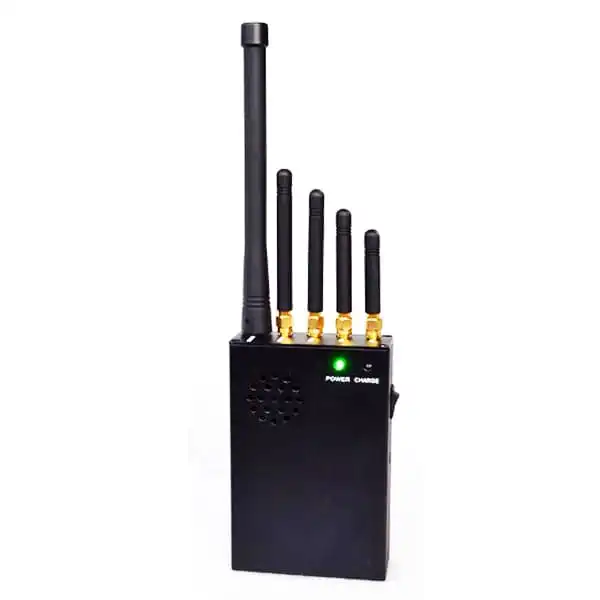
Handheld Cellular and GPS Jammer
Portable unit covering cellular and GPS bands.
 MJ-12A12W
12-Band Portable Jammer
Portable alternative for cellular and radio bands.
 TAD-J300
Anti-Drone Torch
Compact option focused on GPS interference.
 RIL-JAM
Wideband Jammer Detector
Detects interference rather than generating it.
Contact our team
Request a ZeroTrace Quote
Tell us about your requirements. We’ll help assess suitability and provide pricing.
Or call: +39 080 302 6530